

Most of us are using GPS maps on a regular basis. They work extremely well for planning journeys outdoors but often fail indoors. This is where blue dot positioning comes in. It’s a digital version of the “you are here” marker often seen on static maps, which you may have seen in places like airport terminals, malls, hospitals and theme parks.
What is Blue Dot Positioning?
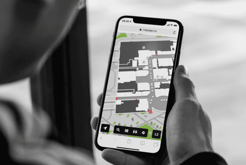
Blue dot positioning, also known as indoor positioning, refers to the little blue dot you see when you use a digital map. It isn't always blue, but that's often the standard. If you’re using a good wayfinding kiosk, the blue dot will show you exactly where you’re standing in a building, no matter the floor you’re on. If the wayfinding software offers mobile hand off, the blue dot will move with the user as they move around the building with the map on their phone.
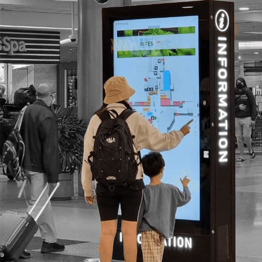
When a user searches for a destination on the interactive kiosk, the wayfinding software will use the location of the kiosk, or the user’s phone, to map a route from their current location to their destination, often shown via a blue line, which takes into account steps or lifts, corridors that may be closed and more.
A blue dot indoor positioning system is a great alternative to GPS, as it’s more accurate and works more reliably indoors.

Why Can’t You Use GPS Indoors?
Physical structures block, weaken, or reflect the very weak radio waves transmitted by satellites orbiting high above the Earth, meaning GPS struggles to be accurate indoors.
Walls, floors and roofs block the satellite signals, making GPS less precise than when you’re using it as a satnav outdoors. It especially struggles in multi-level buildings where floor-level accuracy really matters.
GPS shows users a broader view, whereas blue dot navigation allows venues to get down to the detail, and can take multiple floors into account, making it much easier for users to navigate your building.
Blue dot indoor positioning systems communicate where a device is, right now, inside a specific building. They use technology inside the building itself to ensure more accuracy than GPS can offer.
The Benefits of Blue Dot Wayfinding
Blue dot changes wayfinding from “Here’s a map, good luck!” to “Here’s exactly where you are and where to go next”. This shift benefits visitors, staff and the business running the venue.
A Less Stressful Visitor Experience
Blue dot wayfinding creates a less stressful visitor experience, by removing the “Where am I?” step entirely, showing progress along a route in real time, confirming wrong turns fast so visitors can correct their route, and supports rerouting if the user goes off course. This builds visitor confidence and removes stress from situations that shouldn’t be stressful.
Less confusion means visitors arrive calmer and on time, and they’re more likely to stay longer and return. In malls, stress-free journeys give people more time and energy to browse and spend. In airports, passengers who find their gate with confidence have more time to relax in shops and restaurants.
Fewer Staff Interruptions
Since visitors can self-serve with clear, step-by-step instructions, staff avoid being interrupted by repetitive questions. This frees staff up to deal with the situations that really do need a person. The saving adds up, especially in venues where directional questions are constant.

Accessibility and Inclusion
Blue dot navigation offers a more tailored experience to people with accessibility needs, whether that’s wheelchair users, people with limited mobility or impaired vision, or people with prams.
Interactive wayfinders support accessible routing that avoids stairs and steep gradients, instead opting for lifts and ramps. Indoor positioning also gives continuous orientation, which helps people who find fixed signage hard to use.
Pairing this with accessible interface design, such as readable fonts, strong contrast, adjustable screen positioning and touch target sized for easy use, and visitors with accessibility needs will be able to navigate your space with ease.
Accessibility is both the right thing to do and a compliance matter. Venues need to meet standards such as ADA, the European Accessibility Act (EAA) and the UK’s DDA/Equality Act obligations. Acquire’s Wayfinder, for example, is built with ADA, EAA and DDA compliance in mind. A blue dot with accessible routing makes independent navigation realistic for far more people.
Smarter Location-based Engagement
Venues want to promote offers, events and key destinations, but generic messages are easily ignored by visitors.
Interactive wayfinders let promotions be relevant to where someone is and where they’re heading. You can promote nearby venues with prompts such as “You’re 3 minutes from…”, and can highlight events, new openings or featured tenants along a visitor’s route.
Contextual messages are far more likely to be noticed than blanket promotions. For venue operators, this creates new revenue from sponsored placements and promoted destinations and gives tenants a tangible benefit.

Analytics That Show How People Actually Use Your Space
Venue teams often make decisions about layout, signage and marketing based on assumptions rather than real behaviour.
The blue dot reveals popular routes, destinations and bottlenecks and shows dwell times in different areas, meaning you can make informed decisions about infrastructure. It highlights what visitors search for, including destinations that don’t exist yet and may be worth adding. The analytics give evidence for decisions about space use, tenant mix and signage placement.
The data turns wayfinding from a visitor feature into a business intelligence tool. Operators can see where visitors struggle, adjust signage or layouts and demonstrate footfall and engagement to tenants and advertisers.
Remember, positioning analytics are most useful and trusted when they’re anonymised and transparent. Make sure you’re following local rules about data handling, such as GDPR and CCPA.
A More Consistent Journey Across Devices
Visitors move between planning at home, finding a kiosk on arrival and navigating on their phone. If each step feels disconnected, people give up.
Blue dot navigation lets a route start based on a website or kiosk continue on a mobile device. It keeps the same map, search and routing across touchpoints meaning users know what to expect and can transition across platforms with ease. It gives visitors a single, continuous journey from pre-visit planning to arrival at their destination.
Want to see what intuitive 3D wayfinding could look like in your venue? Book a chat with our team.
How Indoor Positioning Works
Indoor positioning systems communicate where a device is, right now, inside a specific building. They measure signals, sensors or visual cues to show accurate positioning and directions. Blue dot systems are often made up of multiple pieces of technology, and many real-world deployments combine several of them.
We work with many partners who are experts in building blue dot positioning infrastructure that supports our interactive 3D wayfinding software, so if this starts to sound complicated, we can point you in the right direction. Just get in touch!
Bluetooth Low Energy Beacons
Bluetooth Low Energy Beacons (BLE) are small battery-powered transmitters that are placed around a venue, usually on walls or ceilings. You’ve probably seen them in airports or malls. Each beacon broadcasts a unique ID, which can be picked up by kiosks around the venue, or a visitor’s phone. The kiosks or phone can then estimate their distance from each other based on the strength of the signal being broadcast by the beacons.
BLEs are relatively low cost per unit and work with almost all modern smartphones and digital kiosks. They don’t use a lot of power, so don’t be put off by them using batteries, as they often last years. BLEs are a mature, well-supported technology which are often supported by other technologies. Hardware does need to be installed throughout your venue and needs to be smartly placed to avoid signals being blocked by people, metal and glass, but good planning from the outset can reduce these issues.
Bluetooth Low Energy Beacons are ideal for shopping centres, airports, museums and hospitals where metre-level accuracy is enough.
Wi-Fi Positioning
There are two common approaches to Wi-Fi positioning. The first is fingerprinting, where the venue is surveyed in advanced to record the Wi-Fi signal at many points across the property. A device’s live readings are then matched against that map. The second approach is round-trip time (RTT), where newer Wi-Fi standards allow devices to measure the time signals take to travel across access points, which gives a more reliable measurement of distance than signal strength alone.
Wi-Fi positioning often uses infrastructure you already have, meaning you don’t need to add extra beacons, and it’s ideal for wide open spaces. There can be challenges with compatible access points and devices for RTT, and accuracy can vary a lot between buildings. The initial fingerprinting takes survey effort and needs recalibrating when layouts change.
Wi-Fi Positioning works well in large venues that already have strong Wi-Fi coverage and don’t need pin-point precision.
Ultra-wideband (UWB)
Ultra-wideband sends very short radio pulses across a wide frequency band. Because it measures time of flight rather than signal strength, it can calculate distance very precisely. Fixed anchors installed across your venue communicated with UWB-enabled devices or tags.
UWB has the highest accuracy of the mainstream indoor positioning options and are resilient to signal reflections and interferences. It’s ideal for tracking assets and equipment. Because it’s the highest accuracy it has a high infrastructure cost compared to the other options. It also needs UBW-capable devices or tags, which can be added to assets and equipment but my not be compatible with kiosks or phones. It’s often more than a visitor wayfinding system needs, but it’s great for hospitals who need to track equipment, industrial sites, warehouses and any scenario where you need centimetre level accuracy.
Sensor Fusion and Pedestrian Dead Reckoning
Sensor fusion works by using the accelerometer, gyroscope, magnetometer and barometer that already exist in many modern smartphones. Pedestrian dead reckoning (PDR) uses these features to estimate movement from a known starting point by counting steps, estimating a person’s stride length, detecting direction changes and using air pressure to spot floor changes. Some systems also use the building’s unique magnetic field distortions as a positioning aid.
PDR is very good over short distances, such as getting a visitor from a wayfinding kiosk to a shop they want to visit in a shopping centre. The further someone walks, the more errors can occur (often called drift), but this isn’t an issue over shorter distances.
PDR needs no installed infrastructure and smooths out the jumpiness of some of the signal-based methods above, making it a great supporting level alongside them. It helps detect floor changes in multi-storey buildings too, helping visitors navigate more complex spaces. It’s limited on its own and needs an accurate starting point but can enhance other blue dot technology. It makes the blue dot journey on a mobile device look smoother even if the signal drops.
Visual Positioning and QR Code Anchors
Visual positioning systems (VPS) use the phone camera to recognise the surroundings and match them to a stored model of the space. A simpler alternative is to place QR codes around the venue, which, when scanned by a visitor, immediately tells the system their exact location.
QR anchors are cheap and quick to deploy, plus they don’t need any power or maintenance. VPS needs detailed visual mapping of the space and relies on visitors using their camera and actively scanning the QR codes.
This is ideal for kiosk to mobile handoff, which allows the visitor to take the map they have just been viewing on a kiosk with them on their phone.
Why Most Real-World Systems Combine These Methods
No single technology is perfect. A typical setup might use BLE for the main position, sensor fusion to keep movement smooth, and QR codes to correct errors and set a reliable starting point. Blending them produces a blue dot that feels stable and trustworthy, which is key if you want visitors to use your wayfinder again and again.
Whichever method you choose, remember positioning alone doesn’t help a visitor. The blue dot must sit on an accurate, easy to read wayfinding map with sensible routing. That’s why the map layer is just as important as the positioning technology.
Conclusion
Blue dot positioning has changed what visitors expect from a building. People are used to a moving dot on their phone telling them exactly where they are outdoors, and they expect the same indoors.
The technology behind the dot, whether BLE beacons, Wi-Fi, UWB, sensor fusion or visual anchors, matters. But positioning on its own doesn’t get anyone to their destination. The best results come when accurate positioning sits on a clear, up-to-date map with smart routing, accessible design and a seamless journey from website to kiosk to mobile. Built by humans, for humans.
For venue operators, the payoff goes beyond happier visitors. Fewer staff interruptions, more inclusive navigation, targeted promotions and real data on how people move through your space all make a strong business case.
If you’re exploring indoor navigation for your venue, start with the fundamentals:
What accuracy do you actually need? Metre-level is enough for most venues.
How will you keep maps up to date? Layouts change, and out-of-date directions erode trust fast.
How will visitors move between touchpoints? Planning at home, finding a kiosk and navigating on a phone should feel like one journey.
Getting these right gives you a wayfinding experience visitors will trust, and one your team can maintain.
Ready to Make Your Space Easier to Navigate?
Whether you’re planning a new wayfinding project or upgrading an existing one, we can help you create an intuitive, accessible experience across interactive wayfinding kiosks, web and mobile. Want to see what intuitive 3D wayfinding could look like in your venue? Book a chat with our team.
what's next
Want to know more?
Book a consultation with our experts
By submitting this form you agree to our terms.